Synergies of citizen science and weather radars
How citizen science and weather radar data can complement each other to provide novel insights into bird migration fluxes at various spatio-temporal scales
Networks of weather radars are increasingly used to study bird migration fluxes. They potentially provide insights into how birds react to ecological barriers and weather events at large scales and how human infrastructure and land use may affect the birds’ lives. Large-scale species-specific solutions are increasingly needed to support risk mitigation and conservation actions along migration corridors at appropriate scales. In this context, weather radars (WR) have incited the interest of biologists in recent decades, given the worldwide distribution of these radars in large networks with overall about 1000 radars. They represent a unique opportunity to study simultaneously and continuously regional to continent-wide dynamics of aerofauna and to address concerns related to increasing human-wildlife conflicts in the air. There is just one major downside: weather radars do not recognize species. Tools for the spatio-temporal validation of faunistic interpretations of weather radar measurements in situ are only sparsely available. Citizen science bird observation repositories established in the past 20 years have accumulated hundreds of millions of entries of species-specific information across vast areas. Together with other citizen science data sources, these databases can relieve the taxonomic shortcomings of WRs and thus extend and refine the use of WR data. An example is presented in Figure 1.
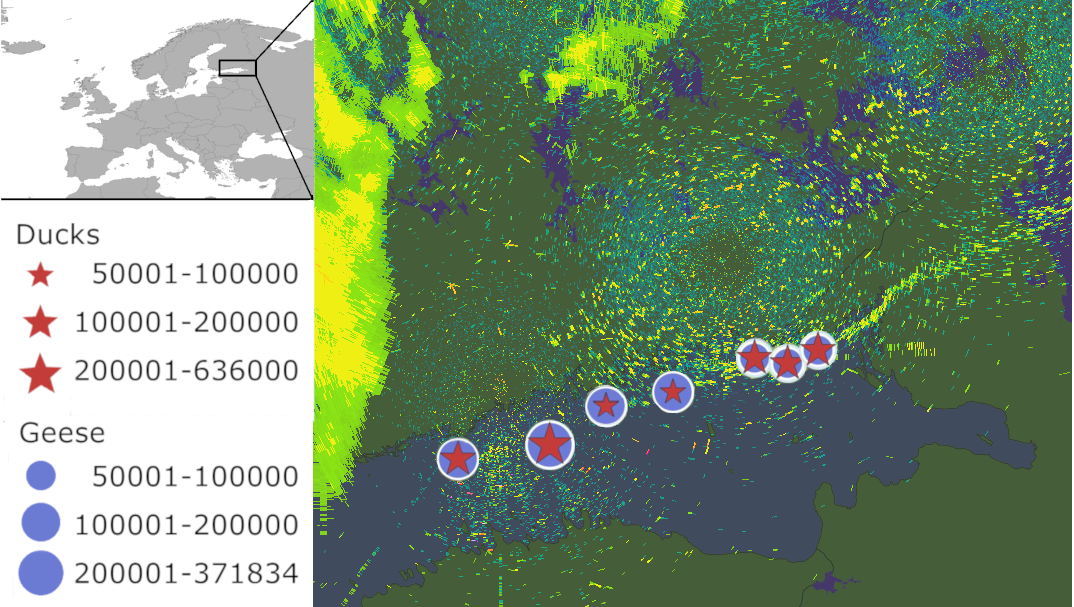 Figure 1. Arctic waterfowl migration in the Gulf of Finland as depicted by weather radars on 17 May 2017 and locations of bird observations reported on the Finnish bird portal Tiira.
In the Forum paper Weisshaupt et al. (2020), we present features and qualities of ornithological citizen science and weather radar data, and their potential to study regional to continent-wide aerial movements of birds. The paper discusses specific fields of applications where maximum information yield is to be expected, recent developments in weather radar data analysis, and in which way combined approaches would support biological research and derived data products and services for stakeholders e.g. in aviation, the environmental sector, meteorological service providers and the general public as beneficiaries.